Plate Nº 59 · recorded November 4, 2026
Space & AstronomyReported finding
NASA Drone Test Pushes Lunar Landing Tech Toward Flight
NASA flew its SPLICE lunar landing guidance system on a drone over California on Aug. 27, capping nearly a decade of development ahead of Moon missions.
By Elena Vasquez4 min read725 words
In brief
- An Alta-X drone flew NASA's SPLICE payload through simulated lunar descent and landing on Aug. 27, 2026, at Rogers Dry Lake, California.
- SPLICE builds high-resolution digital elevation maps from sensor data and diverts to a safer site if the target landing area is unsafe.
- The Aug. 27 flight capped nearly a decade of development, project manager Davis Adams said.
- NASA plans to release the guidance system in its software catalog this fall.
- A full-scale test at Voyager Technologies in Mojave, California, is scheduled for later this month.
By Elena Vasquez
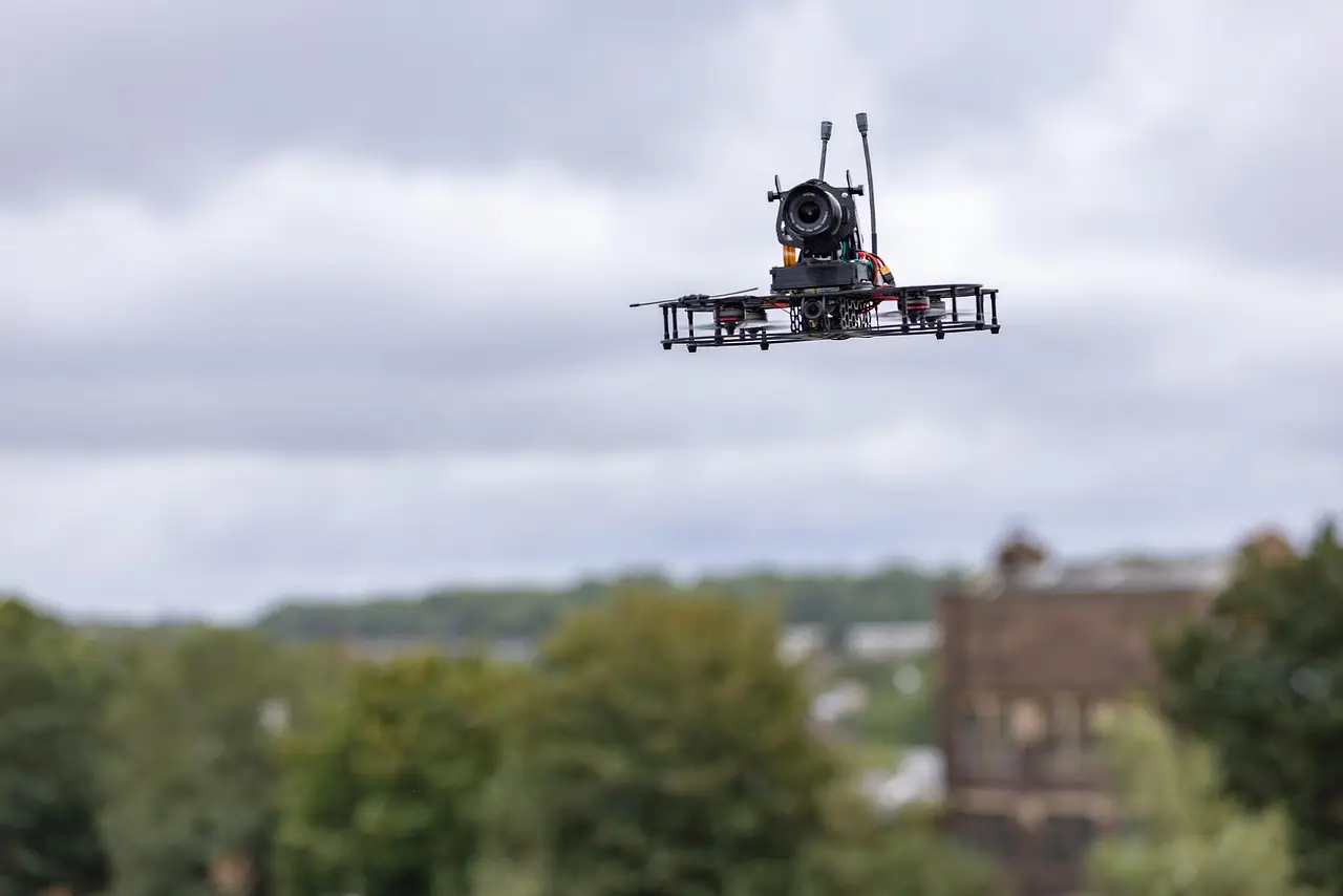
NASA has successfully demonstrated a guidance system built to land spacecraft autonomously — and safely — on the Moon and Mars. An Alta-X drone carrying the agency's Safe and Precise Landing – Integrated Capabilities Evolution payload, known as SPLICE, completed simulated lunar descent and landing maneuvers on Aug. 27 at Rogers Dry Lake near NASA's Armstrong Flight Research Center in Edwards, California.
The flight capped nearly ten years of development. "This flight test is the culmination of almost a decade of work, for the SPLICE project," said Davis Adams, NASA project manager. "This flight raised the technology readiness level, priming it for integration into future robotic and crewed lunar flights. Validation of the guidance and navigation systems are applicable to terrestrial, lunar, and Martian descent and landing missions."
That last line matters. One system, three destinations: Earth, the Moon, and Mars.
How does the system avoid hazards?
During the tests, the SPLICE payload used an advanced guidance system to map the terrain below and assess candidate landing areas in real time. Think of it as the spacecraft making its own judgment call during the final seconds of descent.
The process works like this:
- Light-detection and sensor data feed the onboard computer during descent.
- The system converts that data into high-resolution digital elevation maps — detailed 3D models of the ground.
- It scores the targeted landing area for safety.
- If the area looks unsafe, the system diverts the aircraft to a better spot on its own.
No pilot input. No ground control in the loop. That autonomy is the whole point, because radio signals between Earth and the Moon carry delays that make remote steering impractical during a landing.
The takeaway: the software doesn't just steer to a target — it can change its mind when the ground beneath it turns hostile.
Who built it, and what came before?
Researchers at NASA's Johnson Space Center in Houston developed the SPLICE payload. They partnered with specialists at NASA Armstrong to integrate, test, and fly it aboard the Alta-X drone in June and July. Those earlier flights verified communications, data handling, telemetry, and command-and-control performance between the payload and the aircraft.
The July 15 flights near Armstrong showed SPLICE successfully communicating with the remotely piloted aircraft during hover maneuvers. Justin Link, a small uncrewed aircraft pilot, chief pilot Justin Hall, and project manager Adams ran the field tests.
The campaign prepared the team for a full-scale test at Voyager Technologies in Mojave, California, later this month.
Is this technology already heading to the Moon?
Partly, yes. NASA has worked with several commercial lunar lander providers to implement iterations of SPLICE on their platforms. A number of the landers slated for upcoming Moon Base Phase One missions lean on data NASA collected while developing systems like SPLICE to pull off soft touchdowns on the lunar surface.
The agency also plans to release the guidance software publicly. "We are coordinating with industry regarding the usage of the guidance system once the system is available in the NASA software catalog, currently planned for this fall," Adams said. "Some of the companies also are evaluating the system's navigation capabilities for precision landing applications, as well as potential extensions for autonomous surface mobility."
That word "mobility" hints at a second life for the software — steering rovers and other vehicles across terrain, not just down onto it.
What's the track record?
SPLICE didn't appear out of nowhere. NASA's Flight Opportunities project, based at Armstrong, enabled early flight testing that laid the foundation for the technology's current maturity level. That testing included a descent altitude and landing trajectory in 2019 similar to what a lunar mission would face, plus the demonstration of two NASA-developed precision landing sensor systems in 2020 under a Tipping Point partnership with Blue Origin.
One caution: a successful drone flight over a California dry lake is not a lunar landing. The real verdict comes when SPLICE-derived systems touch down on the Moon. But the Aug. 27 test moved the technology a concrete step closer to crewed and robotic flights — and put a release date on public availability this fall.
In short: after a decade of work, NASA's self-steering landing software is nearly ready for the catalog, and the Moon is first in line.
via images-assets.nasa.gov (Original)
More from Elena Vasquez
Show full bio
Correspondent covering money, funding and market shifts around general science news at SciBeat.
293 articles
Nearby plates
- NASA Picks Three New Payload Suites to Scout Its Future Moon Base
- NASA Picks Three Missions to Find Caves, Ice and Hazards for First Moon Base
- NASA Picks PSI-Led Team to Probe Possible Cave Beneath Lunar Pit
- NASA's SSPICY Mission to Test Autonomous Satellite Inspection in Orbit
- Mars Express Releases 4-Minute Aerial Tour of 460-km Schiaparelli Crater