Plate Nº 98 · recorded October 2, 2026
Earth & ClimateReported finding
NASA Catches a Fire-Made Thunderstorm Over an Idaho Grass Fire
NASA's INSPYRE campaign spent six weeks hunting fire-made thunderclouds. In August, a surprise pyroCb over an Idaho grass fire finally gave the team its catch.
By Marcus Bennett5 min read1,070 words
In brief
- INSPYRE is the first aircraft campaign designed specifically to study pyrocumulonimbus clouds, which can inject smoke 30,000–50,000 feet up, into the stratosphere.
- On August 26, an unexpectedly intense Idaho grass fire produced a pyroCb that the NCAR Gulfstream jet sampled roughly an hour after eruption, flying through the plume for three hours.
- Researchers combined an NCAR Gulfstream jet, NASA's ER-2 with 14 instruments, and ground trucks to measure smoke particles, gases, ice crystals, and radiation from fire-generated storms.
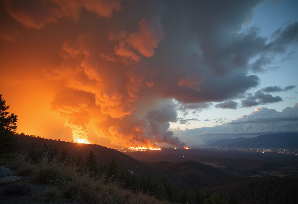
On August 26, a grass fire in eastern Idaho erupted with a massive pulse of smoke that no one on NASA's INSPYRE campaign had predicted. The Wildhorse fire had launched a pyrocumulonimbus cloud, or pyroCb — a towering, fire-generated storm system that scientists with the campaign had spent weeks hunting across western North America.
Pyrocumulonimbus clouds rise above intense fires and behave like thunderstorms the blaze itself created. They produce lightning and rain, along with powerful winds that can whip the flames below into a fury. The largest pyroCbs funnel smoke 30,000 to 50,000 feet (10 to 15 kilometers) above Earth's surface — as high as the cruising altitudes of commercial jets, and even into the stratosphere, the stable layer of atmosphere above the weather we experience at ground level.
INSPYRE, short for INjected Smoke and PYRocumulonimbus Experiment, is the first aircraft campaign designed specifically around studying these clouds. For six weeks this summer, its researchers pursued them with two planes, trucks full of sensors, and a healthy dose of luck.
Why fire-made storms matter
Scientists began to appreciate the significance of pyroCbs around the turn of the 21st century, when satellite observations revealed wildfire smoke reaching altitudes previously associated with major volcanic eruptions. Once in the stratosphere, smoke from a pyroCb can spread across continents, circle the globe, and persist far longer than it would in the lower atmosphere.
Despite their massive size, the clouds remain poorly understood. Researchers want to know how they form and how they interact with the atmosphere, because their smoke can influence climate and weather far from the fires that produced it, and long after the flames have gone out. The clouds also generate dangerous winds of their own.
"We still do not understand if they're driven by fire energetics, or fire intensity, or by atmospheric conditions above," said Olga Kalashnikova, a researcher at NASA's Jet Propulsion Laboratory in Southern California and one of the campaign's principal investigators.
Three views of fire weather
To attack the question, the campaign gathered observations from three vantage points. A converted executive jet — a Gulfstream operated by the National Center for Atmospheric Research (NCAR) and based near Boulder, Colorado — carried researchers who collected smoke particles, sampled gases, photographed ice crystals, and monitored radiation passing through clouds and reflected back into space. The plane crisscrossed above, below, and through clouds for a close-up view of fire-induced weather.
Meanwhile, NASA's high-flying ER-2 aircraft, loaded with 14 instruments, tracked fire intensity, updraft speeds, smoke, and cloud properties from above. Ground crews drove sensor-equipped trucks across the western U.S. to view the same events from below.
Ultimately, the team plans to investigate how wildfire-generated clouds transport smoke upward, how the clouds transform the particles and gases within the smoke, how much smoke reaches the stratosphere, and what happens once it arrives.
Forecasts and climate models
Two practical payoffs could follow. First, firefighting: "A unique thing about pyrocumulonimbus is they are fire-generated weather, meaning the fire makes its own weather," said Neil Lareau, an atmospheric scientist at the University of Nevada, Reno, who led INSPYRE's ground observations. "The fire is making its own thunderstorm, and in the process of doing that, it's also making its own wind."
Lareau hopes the research will lead to warnings comparable to the alerts meteorologists issue for severe thunderstorms. A forecast, for example, could warn firefighters that a developing cloud could soon produce a dangerous downdraft and wind shift, giving fire managers time to pull personnel off the line.
Second, climate modeling. PyroCbs can carry enormous quantities of smoke into the stratosphere, where particles persist for months or longer and alter how much solar energy the atmosphere absorbs and how much reaches Earth's surface. Most numerical prediction models don't explicitly include the effects of pyroCbs and their smoke injections, said Dave Peterson, a Naval Research Laboratory meteorologist and INSPYRE's co-principal investigator. The new measurements should give scientists data to test and improve simulations of these effects on weather and climate.
The hunt pays off
Studying a pyroCb first requires finding one, and that is genuinely hard. The clouds can develop in minutes and subside just as quickly, while reaching a distant fire takes hours of preparation, flight time, and coordination with air traffic controllers.
On August 26, fortune smiled. The Gulfstream was returning from a fire farther west when Sarah Woods, an NCAR scientist serving as spotter from a cramped jump seat behind the pilots, got word that the Wildhorse fire was unexpectedly intense.
The fire hadn't initially attracted attention. "We knew there was a grass fire there, and everyone's like, it's just a grass fire; we're not going to worry about it," Peterson said. "And it ended up being the main event."
As the flight path neared, Woods spotted the fresh remains of a pyroCb. "It looks just like a big thunderstorm, and so as you approach it, you look for a visual indication of the fire on the ground," she said. Seeing the fire far below confirmed the cloud was fire-generated. At Woods' request, the pilots swung the plane around and spent the next three hours flying back and forth through the plume and the trail of smoke drifting northwest toward Wyoming.
The chance encounter gave the team measurements of a pyroCb plume roughly an hour after the cloud first erupted. Other flights, coordinated between the Gulfstream and the ER-2, added observations of active fire-driven airflow that should help document how smoke plumes evolve over the days and weeks that follow.
The analysis begins
The work is far from over. Measurements from both aircraft will now be combined with satellite and ground observations and compared against models. Cloud formation changes smoke chemistry, Kalashnikova noted, and that altered smoke can interact differently with radiation. "When clouds form, they modify chemistry," she said. That makes it important to understand both how pyroCbs form and what emerges from them.
Last summer's challenge was finding the clouds and collecting the data. Now comes the harder part: understanding what the team actually found. The results are preliminary, and it will take time before the observations translate into better fire forecasts or improved climate simulations — but for a first-of-its-kind campaign, the Wildhorse fire delivered a rare, close-up catch.
via jpl.nasa.gov (Original)
More from Marcus Bennett
Nearby plates
- Oklahoma's Hidden Meteor Crater Is 100 Million Years Younger Than Thought
- US-India Satellite Watches a Sleeping Kamchatka Volcano Wake
- Webb Telescope Witnesses Planet-Smashing Collisions Around Young Stars
- Simulations Trace First Stars to Chemical Clues in Today's Universe
- Simulations Reconstruct How the First Stars Forged the Universe