Plate Nº 86 · recorded November 13, 2026
Earth & ClimateReported finding
El Niño Drove Indonesia's 2026 Wildfires, Scientists Find
Scientists attribute Indonesia's 2026 wildfires, which burned 2.88 million hectares, mainly to El Niño, with climate change making fire conditions three times more likely.
By Marcus Bennett3 min read664 words
In brief
- 2.88 million hectares (7.1 million acres) of Indonesia burned in 2026, an area 18 times the size of London
- El Niño cut seasonal rainfall by about half from July to October
- Climate change made the seasonal heat about 1.6°C hotter and fire-prone conditions about three times more likely
- Smoke sickened hundreds of thousands of people in Indonesia and polluted air in neighboring countries
- The burn estimate comes from the Nusantara Atlas; the Indonesian government has released no official figure
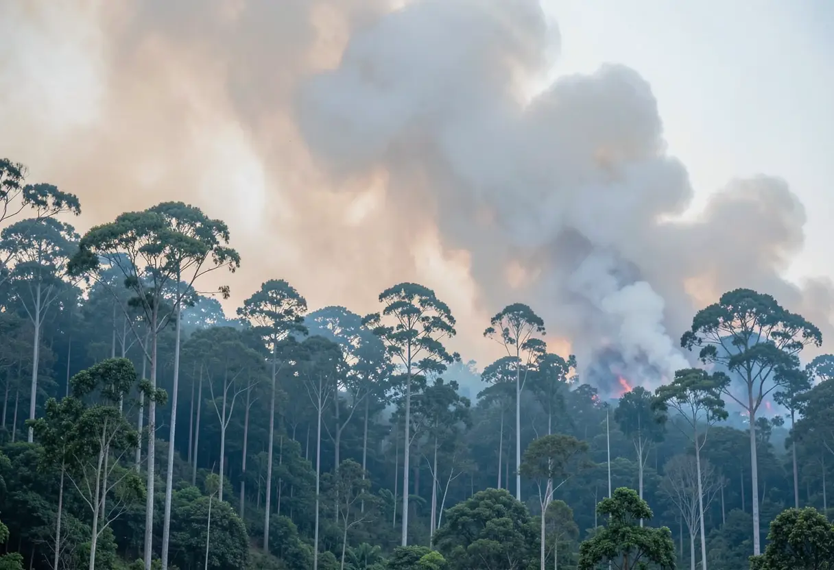
Wildfires have burned 2.88 million hectares (7.1 million acres) across Indonesia so far in 2026 — an area 18 times the size of London — and scientists now say a strong El Niño carried most of the blame.
Researchers from the World Weather Attribution (WWA) group, an international collaboration that measures how climate change influences extreme weather, released their findings on Friday. Their conclusion: an extreme rainfall deficit from July to October, driven largely by El Niño, set the stage for the archipelago's severe fire season.
El Niño is a natural climate pattern that periodically warms the central and eastern tropical Pacific Ocean and shifts rainfall away from Southeast Asia. This year, the researchers found, it cut Indonesia's seasonal rainfall by roughly half.
What role did climate change play?
The report draws a clear line between rising temperatures and the fire-prone conditions. Seasonal temperatures from August to October, the scientists wrote, "were dominated by climate change—primarily from the burning of fossil fuels—which made the seasonal heat about 1.6°C hotter."
The probability shift matters as much as the thermometer. "Human-induced warming made these (fire-prone) atmospheric conditions about three times more likely as well as more intense," the report said.
That 1.6°C figure covers the seasonal heat, not individual heatwaves, and it reflects a rapid attribution analysis rather than a long-term study. WWA's method compares observed conditions against modeled scenarios with and without human-caused warming.
In short: El Niño dried the landscape, and climate change loaded the dice.
Why did the fires spread so far?
Weather alone did not produce the disaster. The researchers flagged three decades of landscape change as a major contributor: deforestation and peatland drainage for agriculture, mining and logging.
Peatlands are waterlogged soils rich in partially decayed vegetation. When drained, they dry out, become flammable and can burn underground for months.
"Indonesia's landscapes have changed dramatically over the last 30 years, with extensive peatland drainage and deforestation creating landscapes that can be extremely vulnerable to ignition," said meteorologist Pramudhian Firdaus of the FLARE Wildfire Research group, who contributed to the analysis.
What did the haze cost in public health?
Smoke from the fires made hundreds of thousands of people ill in Indonesia, where residents breathed toxic haze for weeks. Neighboring countries also registered dangerously high air pollution levels, exposing many more people beyond the archipelago's borders.
The health toll mirrors the 2015 Indonesian fire crisis, when peat smoke sickened people across Singapore, Malaysia and Indonesia. This year's event, while severe, awaits a full epidemiological count.
How solid are the numbers?
The 2.88-million-hectare figure comes from the Nusantara Atlas, a deforestation monitoring platform, and it grew by nearly one million hectares (2.5 million acres) in a single month — a measure of how fast the fire front moved.
The Indonesian government has neither confirmed nor rejected the estimate and has released no official figure of its own for area burned since July. That gap leaves independent monitors as the primary source for the burn tally.
Indonesia experiences fires every dry season, but this year's blazes have been particularly severe.
What would reduce future risk?
Firdaus put the policy prescription plainly: "These findings show how both emissions reductions and sustained forest and peatland protection are important in reducing future risk."
That dual framing is the study's practical takeaway for practitioners in land management and climate policy. Cutting fossil fuel emissions addresses the warming multiplier; protecting and rewetting forests and peatlands addresses the fuel supply.
Neither measure alone, the findings suggest, would have prevented this season's outcome.
Attribution science is young and these results are preliminary in the sense that they await peer review, as is standard for WWA's rapid analyses. Even with that caveat, the direction is unambiguous: a natural climate pattern, amplified by warming and staged on drained land, produced one of Indonesia's worst fire seasons on record.
via phys.org/rss-feed/ (Source)
More from Marcus Bennett
Show full bio
News editor covering regulation, policy and their impact on general science news at SciBeat.
404 articles
Nearby plates
- Indonesia's Underground Peat Fires Are Surging Early in 2026
- Indonesia's 2026 Fires Have Burned Nearly 2.9 Million Hectares
- Climate Change Tripled Iberia's Record 2025 Fire Burned Area
- Amazon Smoke Chokes Manaus as El Niño Fire Season Ignites Early
- Africa's Dry Season Has Shrunk Since 1990 — And So Has Its Wildfire Burn Area