Plate Nº 51 · recorded October 19, 2026
Earth & ClimateReported finding
Two Hidden Magma Reservoirs Found Beneath Nicaragua's Masaya Volcano
Six years of satellite data show two hidden magma reservoirs beneath Nicaragua's Masaya Volcano behaving in opposite ways — near 2 million residents, but no immediate danger found.
By James Calloway4 min read849 words
In brief
- About 2 million people live within 13 miles of Masaya Volcano in Nicaragua.
- Sentinel-1 satellite data from 2018–2024 revealed two magma reservoirs behaving differently beneath the volcano.
- The findings were published in Geophysical Research Letters on October 19, 2026.
- Researchers found no immediate danger to nearby communities.
- Masaya's last major lava flow occurred in 1772, but it persistently emits dangerous sulfur dioxide.
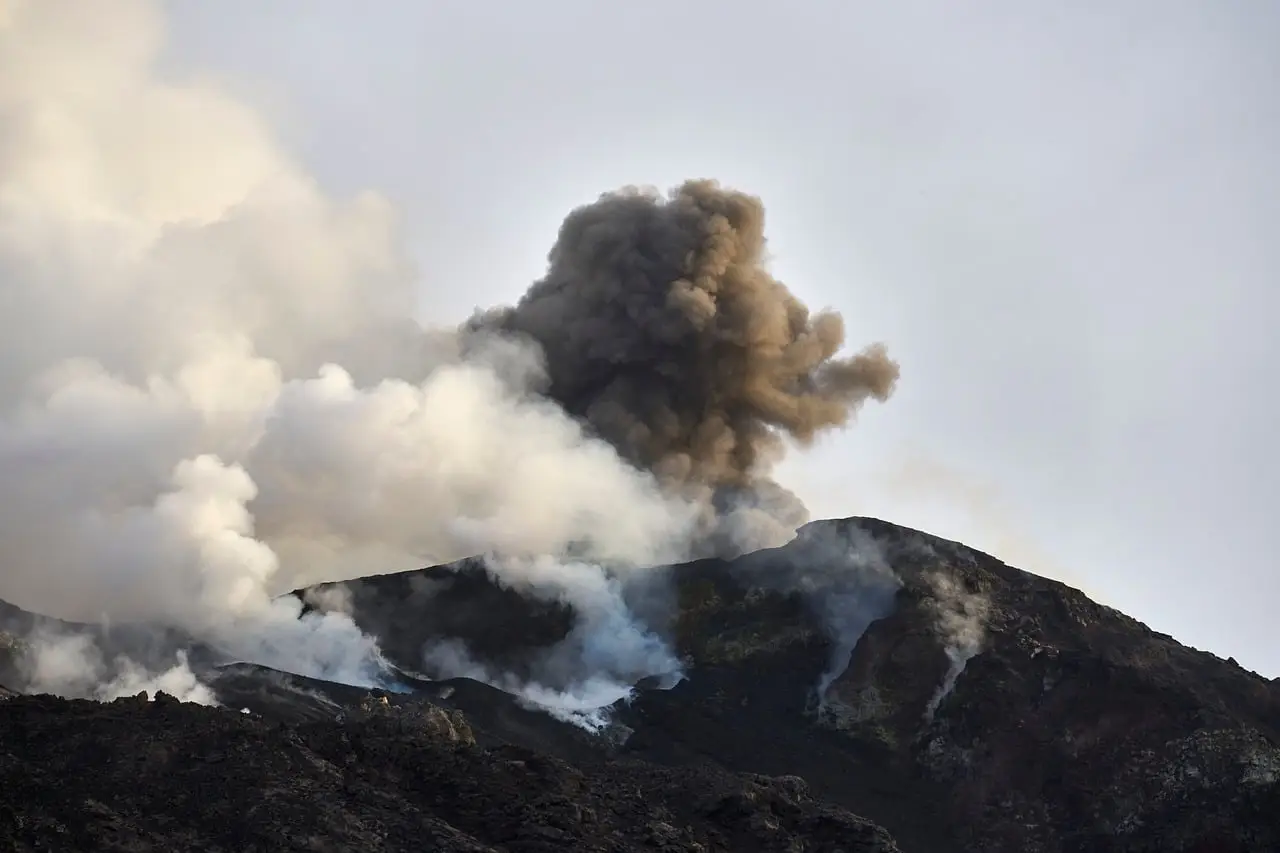
Roughly 2 million people live within 13 miles of Masaya Volcano in Nicaragua, and scientists now say the ground beneath them hides not one magma reservoir but at least two — behaving in opposite ways at the same time. A Penn State team published the findings in Geophysical Research Letters on October 19, 2026, after tracking subtle surface movements from space between 2018 and 2024.
That's the headline. Now the caveats, because there are several.
The researchers saw the ground inside Masaya's caldera — the large depression left when a magma chamber empties and collapses — sink at first, then start rising. Meanwhile, the area right around the active Santiago crater and its famous lava lake kept sinking the entire six years. Different patches of the same volcano moved in opposite directions. That's odd, and it's the finding that matters.
What does this change for people living near Masaya?
Possibly nothing yet, and the researchers say so plainly. Their observations revealed no immediate danger to surrounding communities. What the study offers instead is a baseline: a record of what "normal" looks like underground, so that future anomalies stand out.
Lead author Lizzie Johnson, who finished her bachelor's in geosciences at Penn State in May, put it carefully: "These observations help scientists better understand how magma moves beneath Masaya and may improve monitoring and eruption forecasting in the future."
Note the hedge. May improve. Not will.
How do you watch magma you can't see?
You don't look at the magma. You look at the ground above it. When magma drains from a reservoir, the surface can sag. When fresh magma pushes in and raises the pressure, the surface can bulge upward — uplift, in the jargon.
The team used measurements from the European Sentinel-1 satellite, which passes over Masaya roughly once every 12 days. They applied a technique called interferometric synthetic aperture radar, or InSAR. It works in two steps. The satellite beams microwaves at the ground; radar cuts through clouds, which matters enormously in the tropics. Then interferometry compares the returning signals across dates to catch tiny changes in the distance between satellite and surface.
"Cloud penetration is important for volcanoes because many of them, like Masaya, are in tropical areas where there is often cloud cover," explained Young Cheol Kim, who completed his doctorate at Penn State this summer. "When we look at all the different satellite images across multiple years, we can see how the distance between the satellite and the ground changes, where it is uplifting or subsiding."
Six years of that. No drilling required.
Why two reservoirs instead of one?
The pattern forced the conclusion. Early in the study period, the caldera floor subsided — likely magma draining away. Later, the same area began to rise, suggesting fresh magma arriving from a deeper source. But Santiago crater's surroundings deflated continuously, ignoring the switch entirely.
"When it's subsiding, that means that there's probably magma draining away from the volcano, but once the ground starts uplifting again, that can mean that there's potentially new magma moving in," Johnson said. The independent deflation near Santiago, she added, "indicates that the plumbing system is more complex and could be due to decreasing magma in a second, shallower reservoir."
So the model, and it remains a model: a deeper source feeding the main reservoir, and a separate shallow reservoir near Santiago that's losing magma. Words like "could" and "potentially" carry real weight here. Nobody has directly imaged these reservoirs. The inference rests on surface deformation patterns, which other processes can sometimes mimic.
Why Masaya deserves the attention anyway
Masaya sits near Managua, Nicaragua's capital. It's a national park and a tourist magnet, drawing visitors to its persistent lava lake. Its last major lava flow dates to 1772, which sounds reassuring until you consider its constant degassing — the volcano regularly releases high concentrations of sulfur dioxide, a harmful gas, even without any eruption.
"Having a thorough understanding of Masaya's volcanic activity and its related hazards is critical as around 2 million people live near Masaya," Johnson said.
Kim framed the monitoring logic simply: continuous tracking establishes the baseline, so scientists can spot deviations and, if needed, "warn people in a timely manner."
What's still missing
Plenty. The study covers six years — a blink for a volcano. The authors themselves call for "further long-term geodetic and modeling studies" before anyone claims effective hazard mitigation, at Masaya or at other lava-lake volcanoes like it. The links between these underground reservoirs and what actually happens at the surface remain unproven.
There's also a human footnote worth a line. Johnson did this work as an undergraduate honors thesis in Christelle Wauthier's research group before starting a Ph.D. at the University of Hawaii at Manoa, where she'll now image beneath Kilauea using seismic waves. The research was supported by National Science Foundation awards 1945417 and 2523375.
Two reservoirs, six years of radar, zero confirmed eruptions foretold. A solid step forward — and, as the authors admit, only a step.
via psu.edu (Original)
More from James Calloway
Show full bio
Staff writer covering regulation, policy and their impact on general science news at SciBeat.
243 articles
Nearby plates
- Colombia's Ancient Volcanic Rocks Rewrite the Andes' Timeline
- New Landslide Type Sends Permafrost Slabs Downhill
- A Lost Kilometer-High Cliff May Explain the Grand Canyon's Missing Billion Years
- Cascadia megaquake could shake northern Oregon 17% harder than expected
- 3.1-Billion-Year-Old Rocks Show Water Fueled Early Volcanoes