Plate Nº 18 · recorded November 17, 2026
Earth & ClimateReported finding
Two New Studies Track the Colorado River's Lost Millions of Years
Sand grains on remote Navajo mesas show the Colorado River crossed the Bidahochi basin 6.6 million years ago, cutting the mystery gap to a million or two years.
By Nathan Brooks4 min read755 words
In brief
- Zircon grains found on Bidahochi-area mesas date the Colorado River's presence there to 6.6 million years ago (Science, April).
- A sanidine-based study (Nature Communications, July) traces the river into Utah 25–8 million years ago and downstream of the canyon by 4.8 million years ago.
- Most geologists date the canyon's carving to roughly six million years ago; the river has flushed out an estimated 800 cubic miles of sediment and evidence.
- Karlstrom's team cites a paleocanyon carved 25–15 million years ago; Douglass argues a Great Salt Lake-sized lake spilled over the plateau over about 1.7 million years.
- The canyon debate has run for over 150 years, since John Wesley Powell's 1869 expedition.
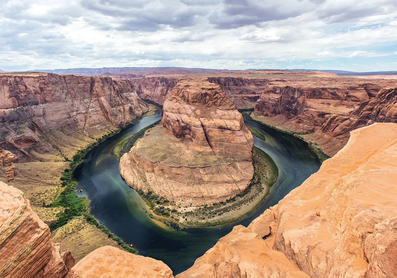
Two studies published months apart have narrowed a five-million-year gap in the Colorado River's history to just one or two million years. The first appeared in Science in April; the second landed in Nature Communications in July. Together they trace the river through a desert basin 100 miles east of its modern course — yet they haven't settled the 150-year-old fight over how the Grand Canyon began.
Why doesn't the Colorado River's path make sense?
Most geologists agree the Grand Canyon's carving started about six million years ago. The puzzle is geography. Before reaching Lees Ferry, the river runs south — then, at the canyon's eastern edge, it veers west, straight through the 9,200-foot Kaibab Plateau. Gravity and water logic suggest it should have found an easier route around that dome of high ground.
"Why does the crazy river come south and then all of a sudden take a hard right and go across an uplift?" asked Karl Karlstrom, a recently retired University of New Mexico geologist who grew up near the canyon and once worked as a river guide.
What did researchers actually find?
A team led by Ryan Crow of the U.S. Geological Survey, John Douglass of Paradise Valley Community College and John He of UCLA sifted sand on Balakai Mesa and nearby mesas in the Bidahochi basin for zircons — tiny, tough minerals whose radioactive decay preserves their age. In the April Science paper, they found zircons unique to Colorado River sands far east of the river's current path. The youngest date to 6.6 million years.
Karlstrom's July study used sanidines, grains recently isolated from other clear minerals in sand. Some originated in volcanic fields in what is now Idaho, carried downstream by the developing river. That team mapped the river entering Utah between 25 million and 8 million years ago, reaching the Bidahochi basin 7 to 6 million years ago and passing downstream of the canyon by 4.8 million years ago.
The evidence matters because so much is gone. The river has flushed an estimated 800 cubic miles of stone and sediment out of the canyon. "A lot of what would inform this story has been removed by the incision that made the Grand Canyon so spectacular," Crow said.
How old is the canyon, really?
Some researchers, including geochronologist Rebecca Flowers of the University of Colorado Boulder, argue the canyon largely dates back 70 million years, carved by rivers flowing the opposite direction while dinosaurs still lived. "At some later point the Colorado River opportunistically exploited this older canyon system," she said. Arizona State geomorphologist Kelin Whipple counters that the topography "screams young canyon." Even Flowers agrees the eastern canyon was carved mostly in the past six million years.
Was there an ancient canyon or a giant lake?
Karlstrom and geochemist Laura Crossey lean on thermochronology — reading the cooling history of minerals as rocks rise toward the surface. Their data suggest a vanished river carved a paleocanyon across the Kaibab 25 to 15 million years ago, cutting more than 2,000 feet below today's South Rim. The Colorado, arriving around 6 million years ago, used that low notch to cross the plateau and cut deeper.
Douglass isn't buying it. "You kicked the entire problem that has fascinated everybody under the rug," he said — whatever carved the paleocanyon would have faced the same plateau. His answer: a lake the size of today's Great Salt Lake, whose lakeshore cross-bedded sands he's found on Balakai Mesa. He argues it spilled over the Kaibab repeatedly, cutting through in roughly 1.7 million years.
The lake camp faces objections too. Spillovers are known below the canyon, but they tend to be catastrophic. "The second that lake starts moving through, it cuts like a knife," Crossey said. Karlstrom adds that a paleocanyon would have drained any large lake, and critics note the basin was traditionally considered too shallow to hold one — though erosion may have erased the proof.
Is the debate actually trivial?
Both camps privately wonder. "My daughter would be like, So there was a lake in both?" Douglass joked. Crow thinks both processes could be involved, with the paleocanyon providing the path for spillover. "I think we agree that multiple processes could have been involved," he said.
Both teams are heading back into the same lonely desert — Douglass hunting shorelines, Karlstrom and Crossey chasing ancient river braids. For now, the canyon's first cut stays open.
via scientificamerican.com (Source)
More from Nathan Brooks
Show full bio
Market editor covering companies, deals and strategy in general science news at SciBeat.
456 articles
Nearby plates
- A Lost Kilometer-High Cliff May Explain the Grand Canyon's Missing Billion Years
- Mantle Motion Explains the Grand Canyon's Missing Billion Years
- Lake Powell Hits Record Low as Snow Drought Strains the Colorado River
- Lake Powell Rises Over 10 Feet, But Still 172 Feet Below Full Pool
- Elephant Butte Reservoir Falls to 1.4% Capacity, Its Lowest Level Since 1971